
Waterfront & Weather
Martinez Announces Marina Closures for King Tides Through January
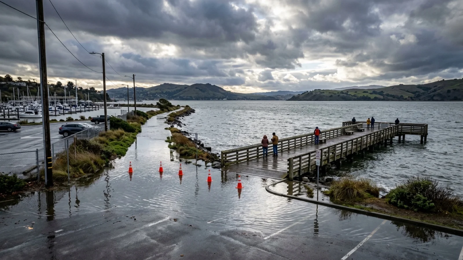
North Court Street beyond Tarantino Drive, the fishing pier, and shoreline trails will close from 8 a.m. to 3 p.m. on five peak tide dates.
Your listening Queue & catch up
Add a story or build a catch-up queue to start listening.
The City of Martinez has announced a schedule of temporary daytime closures at the Martinez Marina and Waterfront Park to protect visitors during upcoming extreme high tide events, according to Claycord. The coastal flood precautions arrive as National Weather Service meteorologists monitor an equatorial Pacific Kelvin wave that is strengthening El Niño conditions ahead of California’s November-through-March rainy season, according to a companion Claycord weather report.
Martinez Marina Closure Dates and Affected Waterfront Areas
City officials stated that closures will run from 8:00 a.m. to 3:00 p.m. on the following dates:
- Wednesday, Oct. 28, 2026
- Wednesday, Nov. 25, 2026
- Wednesday, Dec. 23, and Thursday, Dec. 24, 2026
- Thursday, Jan. 21, 2027
During each closure window, peak water levels in the Carquinez Strait are projected between 11:30 a.m. and 1:30 p.m., when the National Weather Service warns tides could rise 1.5 to 2 feet above normal and inundate low-lying roads, parking lots, and pathways.
The temporary closures cover North Court Street beyond Tarantino Drive, the north parking lot adjacent to the waterfront and yacht club, the Martinez fishing pier, and shoreline trails throughout the marina. City officials noted that the upper parking lots, bocce courts, picnic areas, playground, and athletic fields will remain open to the public.
How a Pacific Kelvin Wave Shapes California’s Storm Outlook
Looking beyond this week’s King Tides, National Weather Service Warning Coordination Meteorologist Michelle Mead explained how a slow-moving oceanic Kelvin wave is influencing the upcoming winter pattern. Triggered when western Pacific trade winds relax or reverse, a Kelvin wave measures roughly 10 centimeters in surface height but spans thousands of kilometers in width, pushing warm water eastward along the ocean’s thermocline—about 100 to 200 meters beneath the surface—over a two-to-three-month journey toward South America.
Because warmer eastern Pacific waters release additional heat and moisture into the atmosphere, they can strengthen the subtropical jet stream across California during the core November-through-March wet season. Forecasters cautioned that while an El Niño pattern increases the likelihood of an active storm track in central and southern California, individual storm impacts still depend on localized atmospheric conditions.
Sources
Comments (0)
No comments yet. Be the first to share a thought on this story.